Northeastern U.S. Under Flood Threat Due to Omega Block That Stalls Rainfall
Floods threaten the United States due to the Omega Block. Find out what’s happening in the country and stay informed.
Posted on 06/05/2025 at 18:12
- US under flood threat
- Omega Block stalls rainfall
- Persistent forecast through Wednesday
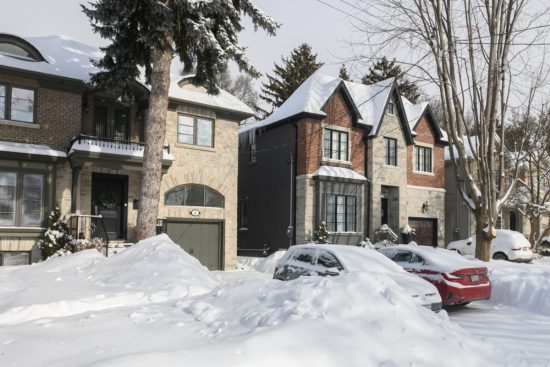
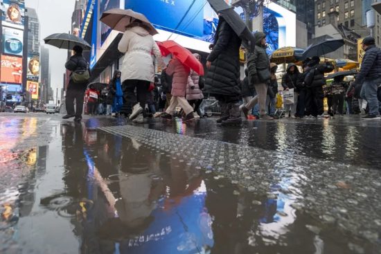
Millions of residents in the northeastern and mid-Atlantic regions of the United States are starting the week under a looming threat: flash floods driven by an unusual weather pattern known as an Omega Block.
This atmospheric phenomenon, named for its resemblance to the Greek letter Ω, is causing low-pressure systems to stall with no ability to move forward quickly.
“It’s a slow-moving pattern that will keep us practically stuck with rain,” explained FOX Weather meteorologist Jane Minar.
The result has been a constant flow of moisture from the Atlantic, generating persistent rainfall and thunderstorms across much of the eastern US.
Northeast on Alert for Heavy Rain

In the Ohio Valley, a cutoff low-pressure system has become detached from the main atmospheric flow, preventing its movement.
“A disconnected low means it’s isolated from the main flow, which means there’s nothing around to guide it,” explained FOX Weather’s Ari Sarsalari.
YOU MAY BE INTERESTED IN: Severe Storms to Strike Central and Eastern US During May
This situation has created ideal conditions for slow and prolonged rain, with occasional breaks but no sustained improvement in the forecast.
Sunday brought scattered showers to several states, especially in mountainous regions like the Catskills in New York and the Poconos in Pennsylvania.
What Is an Omega Block and How Does It Affect Us?
Although there were brief moments of calm, experts warn that the threat of heavy rain will persist through midweek.
Northeastern cities like Buffalo, Portland, and Burlington will remain under cool and humid conditions.
Further south, temperatures will hover around 70°F (21°C), with moderate rain in cities such as Boston, Philadelphia, and Washington.
The NOAA’s Storm Prediction Center (SPC) issued a Level 1 alert for the region on its five-tier severe storm risk scale.
“Today we’re at a Level 1 risk,” said Sarsalari. “It’s a pretty wide zone… from the interior northeast down to parts of the Carolinas and the southeastern coast.”
Rainfall totals are estimated to reach several inches, particularly in areas like the Hudson Valley, western Massachusetts, Vermont, and New Hampshire.
New York City and surrounding areas may see some of the highest accumulations over the coming days.
“This rain is necessary,” Sarsalari noted, “though there’s also a flood threat. It’s not the worst we’ve seen, but it’s still significant.”
Areas Most at Risk of Flooding
NOAA’s Weather Prediction Center (WPC) has marked New England, the mid-Atlantic, and the northeast as high-risk areas.
The flood threat is expected to persist at least through Tuesday, with a Level 1 out of 4 rating on the WPC’s scale.
Although the threat level is considered low, experts emphasize not to underestimate the danger.
Flash floods can develop with little warning and pose a deadly risk to anyone traveling through flooded areas.
“Never drive over a flooded roadway while traveling, and follow local authorities’ recommendations,” experts advise.
Meanwhile, in other parts of the country, the same Omega Block will have the opposite effect, bringing prolonged heat and clear skies.
The weather pattern will stretch from the southern Plains to the Gulf Coast, with rain also forecast in those regions.
Nonetheless, the main focus remains on the East, where the persistent humidity could worsen the risk as the days progress, Fox Weather reported.